
Description
Attributes
- Compatibility: Compatible With Chart Plotters
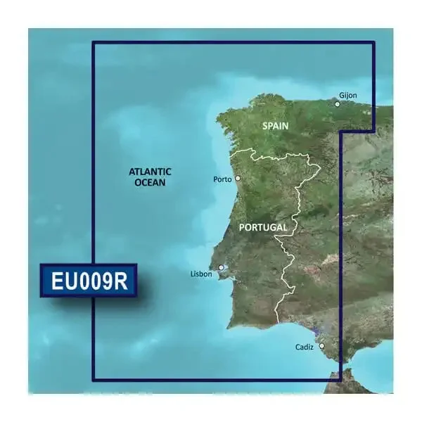
- Chart Coverage: Detailed Coverage Of Gij├ā┬│n To Cadiz And Sevilla
- Storage: On SD/ Micro-SD Card
Product
BlueChart « G3 coastal charts provide industry-leading coverage, clarity and detail with integrated Garmin and Navionics data. Also included is Auto Guidance technology, which uses your desired depth and overhead clearance to calculate routes and provide a suggested path to follow – overlaid onto your chart. NOAA raster cartography is also provided as a free downloadable feature via the ActiveCaptain app. It gives your chartplotter paper chart like views of NOAA-surveyed areas in which individual points of interest are labeled with corresponding longitude and latitude information.
Features & Benefits
- Provides Industry-Leading Coverage, Clarity And Detail With Updated Coastal Charts That Feature Integrated Garmin And Navionics « Content
- Auto Guidance Technology Quickly Calculates A Suggested Route By Using Your Desired Depth And Overhead Clearance And Provides A Suggested Path To Follow
- Provides Depth Range Shading For Up To 10 Depth Ranges, Enabling You To View Your Target Depth At A Glance
- Up To 1 Foot Contours Provide A More Accurate Depiction Of The Bottom Structure For Improved Fishing Charts And Navigation In Swamps, Canals And Marinas
- To Aid In Navigation, Shallow Water Shading Allows Map Shading At A User-Defined Depth To Give A Clear Picture Of Shallow Waters To Avoid
- NOAA Raster Cartography Is Provided As A Free Downloadable Feature Via The ActiveCaptain « App
- NOAA Raster Cartography Gives Your Chartplotter Paper Chart like Views Of NOAA-Surveyed Areas In Which Points Of Interest Are Labeled With Corresponding Longitude And Latitude Information
- Limited One Year Consumer Warranty
Reviews
There are no reviews yet.