
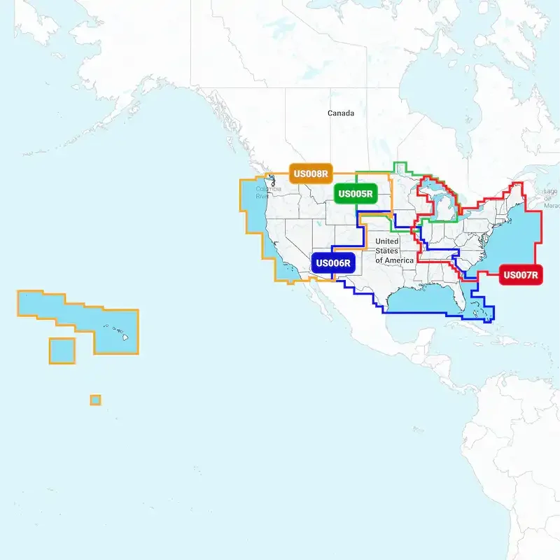
Description
Attributes
- Compatibility: ECHOMAPÖ UHD, ECHOMAPÖ UHD2/ Ultra, GPSMAP(R), LiveScopeÖ And PanoptixÖ Chart Plotters
- Chart Coverage: Detailed Coverage Of West Inland And Coastal
- Storage: On SD/ Micro-SD Card
Product
Featuring vibrant colors, a streamlined interface and combined coastal and inland content with a popular Navionics « style color palette, Garmin Navionics+ cartography makes it easy to plot your course with the worldÆs No. 1 name in marine mapping. The downloadable sonar imagery feature reveals bottom hardness clearly and in contrasting color, highlighting both subtle and dramatic transition areas on select U.S. lakes. Crystal-clear aerial and surface photos of ports, marinas, bridges, docks, boat ramps, dams and navigational landmarks provide a better sense of your surroundings above the waterline. This view provides a 3D representation of the surrounding area both above and below the waterline. Adjust your maps to the lakeÆs current water levels to see if spots are accessible or too shallow to explore.
Features & Benefits
- Navigate With Our Best Offshore And Inland Lake Coverage For Your Garmin Chartplotter
- Customize Your View With Various Chart Layers And Overlay Combinations
- Auto Guidance+ Ö technology2 lets You Navigate With Suggested Dock-To-Dock Routings
- High-Resolution Depth Range Shading Lets You Select Up To 10 Color-Shaded Options And View Your Designated Target Depths At A Glance
- For Improved Fishing And Navigation, Up To 1 Feet Contours Provide A Clear Depiction Of Bottom Structure For Improved Fishing Charts And Enhanced Detail In Swamps, Canals, Harbors, Marinas And More
- To Give A Clear Picture Of Shallow Waters To Avoid, This Feature Allows For Shading At A User-Defined Depth
- Downloadable High-Resolution Satellite Imagery4 provides Superior Situational Awareness
- Downloadable Shading Feature combines Color And Shadow To Give You An Easy-To-Interpret, Clearer View Of Bottom Structure Than Contour Lines Alone
- Underwater Perspective Shows 3D Representation Of Bottom And Contours As Seen From Below The Waterline. Interface With Sonar Data For A Customized View
- Limited 1 Year Warranty

Reviews
There are no reviews yet.